Sichuan–Tibet Highway Day 4 – Yading Trek: A Self-Torturous Adventure
After devouring a steamer basket full of buns, we drove from Daocheng to the Yading Scenic Area. Today was designated for hiking – it had been ages since we last tackled a high-altitude trek, so replenishing our energy was essential.

The gloomy, rainy days of the past had finally ended, and today the sky was filled with billowy white clouds and brilliant blue—a clarity so intense it left one breathless. Perhaps it wasn’t only the vivid blue, but also the thin, oxygen-deprived air that made us feel faint.

Along the road from Daocheng to Yading, the sacred mountain emerged in clear view. Herdsmen driving cattle, sharply contoured snow-capped peaks, a half-moon suspended in the sky, and colorful prayer flags drifting in the air—all these scenes, bathed in sunlight against a deep blue sky, were breathtaking.
“Yading” in Tibetan means “the Land of Sunshine.” Its centerpiece consists of three completely separate snow peaks arranged in a “pin” shape, known respectively as “Xian Na Ri,” “Yangmai Yong,” and “Xia Nuo Duo Ji.”

On the winding mountain road from Daocheng to Yading, one could clearly see the foremost sacred peak – Xian Na Ri, whose Tibetan name means “Avalokitesvara.” It is the highest of the trio, standing at 6,032 meters.

The drawback of chartering a vehicle is its inflexibility with time. After agreeing on a meeting time with the driver, everyone set off at their own pace according to their physical strength. Eager to see the “Milk Sea” high on the mountain, I hurriedly began the trek. Without lingering inside the park, I took an electric vehicle straight to the starting point of the hiking trail – a 10.2-kilometer round trip over more than five hours, ascending from 4,000 to 4,700 meters.

The hike began at a lush wetland where many horses grazed and basked in the sun. Encircled by mountains, the exquisite natural setting was utterly intoxicating.


Before my eyes, Yangmai Yong rose clearly. In Tibetan, its name means “Manjushri’s” and, at 5,958 meters, it is reputedly the most elusive of the three peaks. Once again, the favorable weather moved me profoundly.

In another direction, Xia Nuo Duo Ji could be seen. Also standing at 5,958 meters, its Tibetan name means “Vajrapani,” and it accompanied me along the way.

The area where the horses grazed was in the park’s lower-altitude region—a popular spot for tourists to stroll and take photographs.

Soon, we reached the starting point of the hiking trail. Although one could rent a horse to ascend part of the mountain, the most challenging section had to be climbed on foot. I observed several weary travelers who, unable to climb the steepest stretch on horseback, had to ride back down. I chose to walk; the climb was arduous, and when I grew breathless, my vision blurred. At first I thought it was the harsh sunlight, but I soon realized it was the lack of oxygen causing dizziness – so I kept refueling with chocolate along the way.

The initial flat section was easy, and I even met a few fellow hikers in good condition.

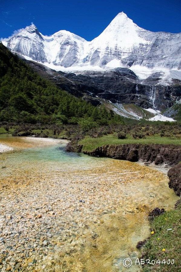
Our first rest stop was a small river whose color was so beautiful it evoked the geysers of Yellowstone. Gazing along the water, the sacred mountain revealed itself in the distance. Excitement swelled within me, though I dared not get overly elated. No matter the angle, even a full-frame camera with a 24mm lens couldn’t capture the entire majestic scene—I truly wished I had a wide-angle lens.

A particularly striking feature caught my eye on the meadow.

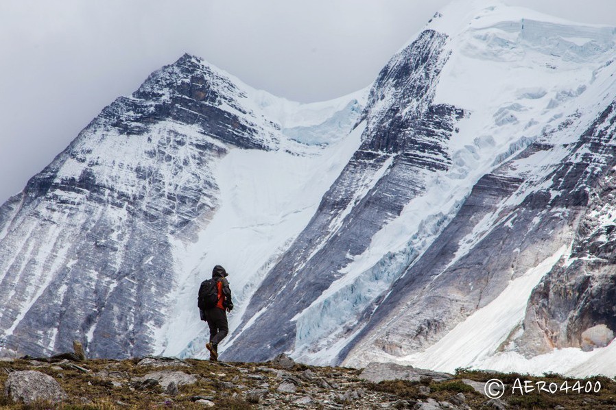
From that point onward, the trail became a steep mountain climb. The wind on the slopes was strong; despite wearing a thick hooded sweatshirt and a windbreaker, my hat did little to protect me as I was buffeted to the point of tears and a continuously runny nose – it was a true struggle to reach the top.

As I ascended further, the foreground of the snow-covered mountains changed – at times a delicate, murmuring waterfall appeared; at other moments, rugged rock formations came into view. Although exhausting, the scenery was never dull.


This path was also commonly used by those riding horses. The trail was littered with piles of manure; to conserve energy, riders would simply step over it without a second thought.


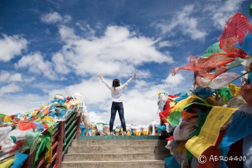
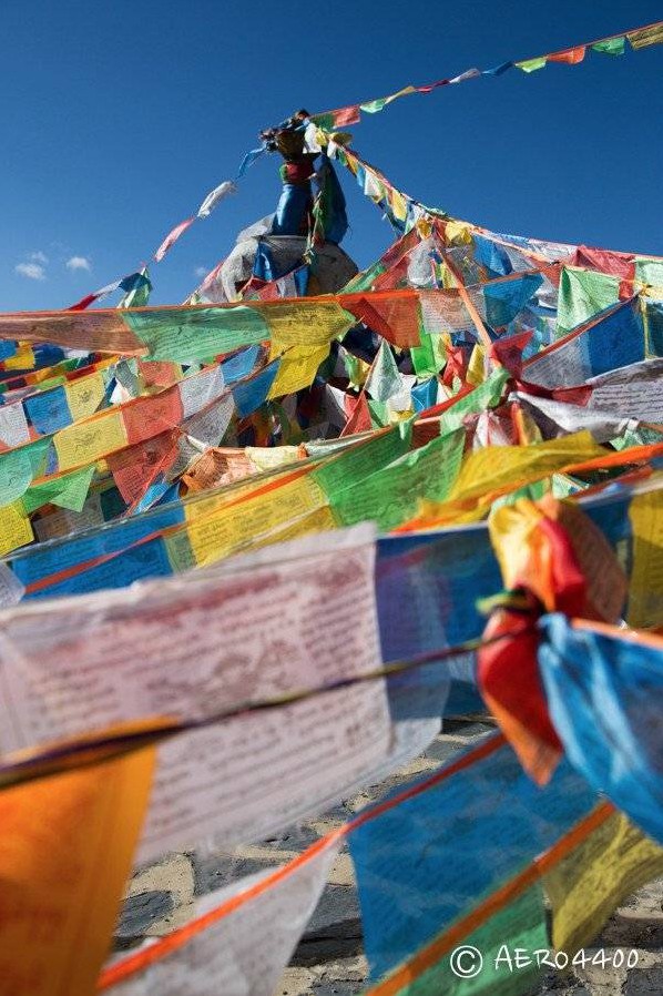
Eventually, I reached a spot festooned with fluttering prayer flags—a scene imbued with authentic Tibetan character. While many rested at the foot of the cliff, I couldn’t keep still and roamed about taking photos.

Looking back, I marveled at just how steep the path had been.


Continuing upward, I inched closer to Xia Nuo Duo Ji. At the base, the landscape was adorned with countless prayer flags offered by local Tibetans.


Beyond the three main peaks, innumerable mountains surrounded the area. Under a clear sky, every view was stunningly beautiful.
Finally, I reached the “Milk Sea” at 4,600 meters – an emerald-blue lake encircled by mountains. I encountered the same group of travelers I had seen at the start; we exchanged knowing smiles and sat on the grass, snacking to regain our strength.


Up close, the Milk Sea revealed an array of colors – varying depths produced different hues that were simply mesmerizing.
After a well-earned rest, I had to climb another slope to reach the “Five-Color Sea.” Halfway up, looking back at the Milk Sea offered an entirely different, majestic panorama.


At the highest point, one could overlook the Five-Color Sea (located at 4,700 meters). Its hues, however, were not as appealing as those of the Milk Sea.
To get close, one must descend the slope – a daunting prospect, as the climb back up is exhausting – but no matter what, you have to reach the water’s edge.
On the return journey, some chose an alternate route that purportedly brought them closer to the scenery. Fearing a delay in rejoining the group, I retraced my steps; although I took a slightly different path at first, I was rewarded with a unique view.
After descending, as a ray of sunlight graced the peak of Xia Nuo Duo Ji, I was filled with overwhelming emotion.


Taking an electric vehicle back to the other parts of the park, and with some time left, I wandered about aimlessly. I strolled through an ancient meadow where the lush green grass was exactly the color I adored, and the horses appeared blissfully content. Nearby, a river was so clear that its bottom was visible—the color was refreshingly dreamy.

After the grueling trek, the headache induced by altitude sickness vanished without a trace. With no further signs of altitude sickness, I returned to Daocheng for a hearty meal to reward myself.


That night, I stayed in the same hotel as the previous day.

Sichuan–Tibet Highway Day 5 – Rerouting from Daocheng Toward Meili
Because the road to Daocheng was too bumpy, neither the driver nor we wanted to retrace our steps. Instead, we opted for the Yunnan–Tibet route, heading toward Feilai Temple and Meili Snow Mountain in hopes of catching a glimpse of the real face of this peak.

The journey offered little in the way of scenery. We passed a dilapidated village—Dayong Village—where the words “Long Live the Communist Party” were painted on a hillside, making one wonder which era the villagers still belonged to.


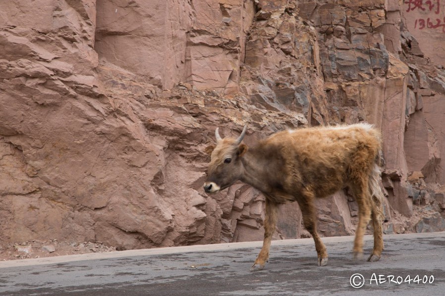
The village was nearly deserted; when a few locals emerged, their faces radiated simplicity and genuineness. At the village’s edge, within a fenced cattle shed, adorable calves grazed. After spending a little time playing with them, we continued on our way.

Further ahead, we arrived at Mabear Village. Here the inns were clearly set up for tourists, and the buildings were noticeably brighter than those in the previous village.

A highlight of the day was driving high enough to overlook these uniquely styled buildings.


At lunchtime, we found a small restaurant for a meal. The weather was hot and dry, so at a nearby convenience store we bought popsicles—each of us happily enjoying one like a child.


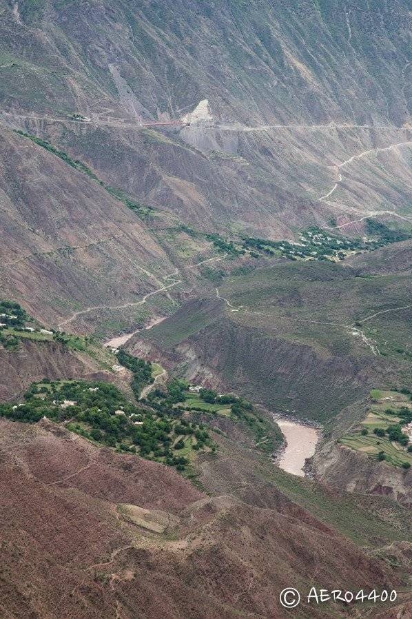
At a bend in the Jinsha River, the confluence of two river channels was evident, with markedly different water colors.


Continuing on, rainy weather set in and the snow-capped mountains along the route were shrouded in thick clouds. By evening, we reached Feilai Temple at the foot of Meili Snow Mountain, though we missed the sunset.


We could only hope for a sumptuous meal and eagerly anticipate tomorrow’s sunrise.


We stayed at Feilai Temple’s Waka Boge Hotel in a standard room for 150 RMB.

Sichuan–Tibet Highway Day 6 – A Rainy Sunrise at Meili Snow Mountain
On the road to Meili Snow Mountain, the driver remarked that seeing this mountain depended on fate – over eighty percent of visitors apparently miss it.
The overcast, rainy night we had experienced foretold that today’s sky would hardly clear. Nonetheless, I clung to a sliver of hope and rose early to head up to the hotel’s loft.
From the loft, I had an excellent vantage point for viewing the snow; right below lay the park’s ticketed viewing platform – on a clear day, an exquisitely beautiful snow mountain would surely appear.

Others who shared my hope briefly visited the terrace, but after a fleeting glance, they returned to their rooms to continue sleeping. The thick clouds were disheartening, so I too resigned myself to more rest.

At the agreed-upon time, after a hearty breakfast, we left the snow mountain that had eluded us. The steamed buns served in the restaurant became a memorable highlight – handmade and reminiscent of a delicious flavor I hadn’t enjoyed since my years in the United States.


Sichuan–Tibet Highway Day 6 – Official Entry into Tibet
We drove along the Lancang River, which runs parallel to National Highway 214. Although the river was turbulent and murky with a forceful current, its color did not appeal to me.


I parked by the roadside to admire the river, and the unique rock formations on the opposite bank caught my attention.

Continuing onward, we crossed into Tibet. Clear road signs marked the transition, and tourists began parking by the roadside to take commemorative photos – naturally, we joined in.


On June 20, 2014, I set foot on the sacred land of Tibet for the first time; from that moment, I fell in love with its pristine beauty.

This entry marked a symbol of high altitude – a gateway to the mysterious lands of Tibet, and it hinted at the even rougher, more challenging roads to come.
Sichuan–Tibet Highway Day 6 – The Ultimate Test of Appetite: Yan Jing Authentic Noodles
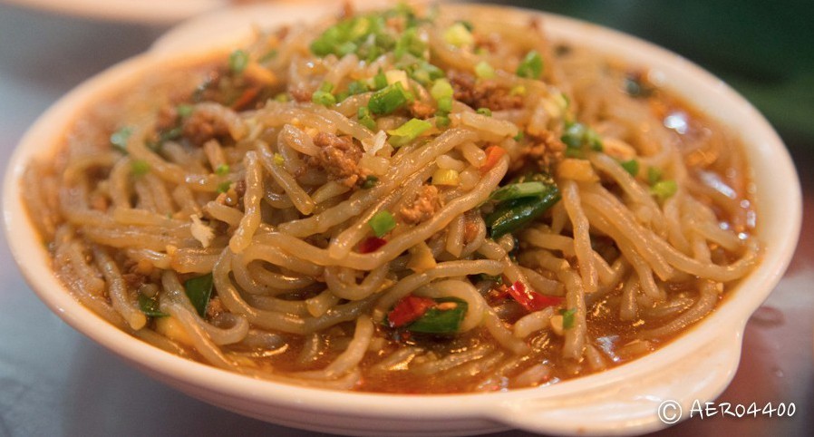
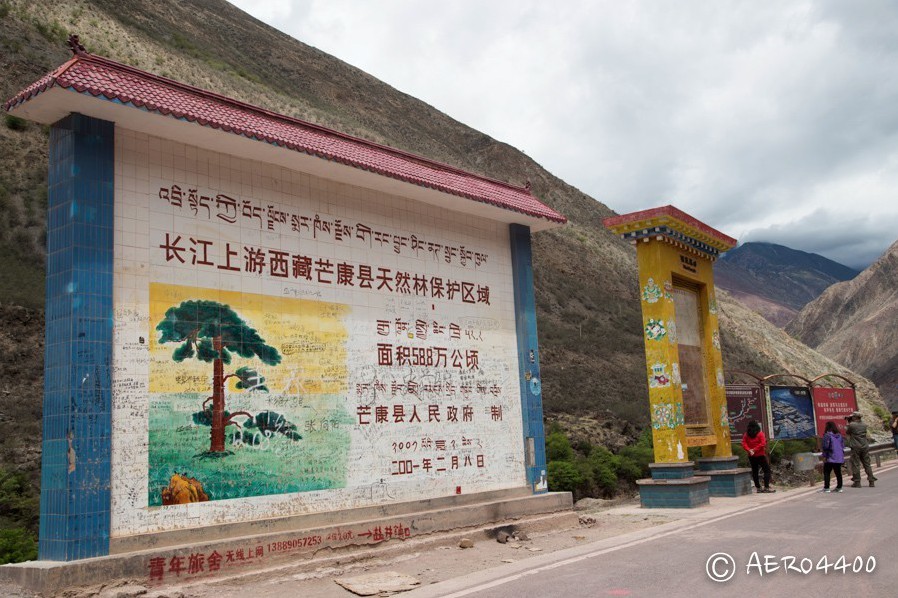
The century-old Yan Jing Authentic Noodle restaurant is located near the millennia-old salt fields of Yan Jing Village, within a Naxi ethnic village in Mangkam County, Chamdo, Tibet.

The interior of the restaurant was clean and tidy, decorated in a distinctly Tibetan style. Although the decor was relatively modern, it still retained its ethnic charm.

Seated at long tables arranged along the wall, the staff busied themselves by presenting a large pot of noodles and an equally large pot of broth, along with a stack of small bowls. A serving of freshly boiled noodles was briefly dipped twice in the savory broth and then garnished with minced meat and scallions before being served.


Each person was given a bowl, and we began eating!


You might think that after spending so much money, you’d only receive a modest portion—but of course not. There were plenty of side dishes, all appetizing and truly filling.
Just a little joke—the sides aren’t the focus. The key point is that the noodles are served without limit. Once you finish one bowl, the waiter promptly refills it, prepared with the same method.
The noodles were wonderfully chewy, and bowl after bowl was consumed. At each table, there was even a basket of small stones; with every bowl eaten, you placed a stone on the table to tally just how much you could eat.

The secret to eating more was to sip as little broth as possible – although the broth was so delectably fresh that it was hard to resist taking a few sips.

When you finally reach your limit, be sure to cross your chopsticks over the bowl to signal that you are full. If you forget to do so, no matter how you protest, another bowl will be poured in. You wouldn’t want to waste food, so you might as well eat it and quickly cross your chopsticks.

Before I knew it, I had eaten 14 bowls – a testament to my appetite. The sign at the restaurant’s entrance even boasted a record of 147 bowls, an astonishing number. If you ever pass by, you should test your own limits.


Sichuan–Tibet Highway Day 6 – Salt Fields Appropriated by the Locals
The ancient salt fields of Yan Jing Village were once just ordinary expanses of salt. However, as more travelers began journeying along the Sichuan–Tibet Highway, these salt fields became a famous scenic spot. Originally, the state merely fenced off a portion of the salt fields at the foot of the mountain and charged an entrance fee. Now, even the roadside vantage points on the mountain that overlook the salt fields have been appropriated by local residents. If you want to park by the roadside and take photos, you’ll have to pay first…
I truly dislike this state of affairs at domestic tourist spots, yet there is little that can be done. The driver managed to find an inexpensive parking spot and negotiated a price with the locals—50 RMB for three vehicles—and everyone got out to take pictures.
Although the canyon was still quite majestic, the intrusive fees left me with no appetite for its beauty. With overcast skies and red salt barely visible without the sun’s illumination—blending with the surrounding mountains—I snapped a quick photo and moved on.


Sichuan–Tibet Highway Day 6 – The Lancang River by My Side
The W-shaped grand canyon of the Lancang River in Mangkam County lies adjacent to National Highway 214. Although the canyon was vast and imposing, the river water was murky and did not exhibit the turbulent majesty one might expect.
The weather that day was particularly dismal, and the entire canyon appeared dark and uninviting.
That night, we stayed at Tianlu Hotel in Mangkam County, with standard rooms priced at 150 RMB. Dinner featured delicious yak hoof and a local specialty known as “bajia,” and one of our companions bought a watermelon that we shared – refreshingly delightful.


Sichuan–Tibet Highway Day 7 – Crossing Mountains, Surpassing 5,000 Meters
From Mangkam to Basu, we drove 359 kilometers – yet another day of bumpy roads and mountain crossings – and set a new record by crossing over 5,000 meters in elevation.


First, we passed through Wula Mountain Pass at 4,868 meters. The prayer flags there were tattered, and the brown hillside featured only sparse patches of grass.


The sky was dark, and low-hanging clouds and fog obscured the mountain peaks, exuding an atmosphere of desolation and damp decay.


After cresting the mountain, we reached a village below where a large herd of sheep suddenly passed by. I couldn’t help but marvel at the wealth of the herders and think of the delicious taste of mutton.

Passing through Rumei Town (formerly Zhuka Town), we saw an old bridge used by the Red Army when entering Tibet – an ancient strategic transportation route.


The old bridge spanned the raging Lancang River, and the precipitous cliffs on both sides looked even more magnificent than the distant view from yesterday.


Continuing on, we reached a new high point at 5,008 meters.

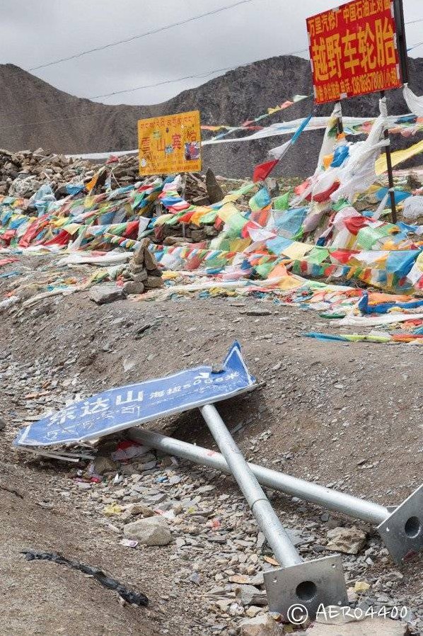
At Dongda Mountain Pass, the scene remained desolate – even the sign for Dongda Mountain lay toppled on the ground, perhaps foretelling the barrenness along the Sichuan–Tibet Highway.


We had lunch in Zuogong, where the river fish were delicious and reasonably priced, much to everyone’s delight. We also picked up a couple of large flatbreads from a nearby steamed bun shop to snack on as we traveled.


Sichuan–Tibet Highway Day 7 – Another Bout of Altitude Sickness Brought on by the Beauty
After many hours on the plateau, everyone gradually adapted to the thin air, and the symptoms of altitude sickness began to ease.

After a hearty meal, we drove from Zuogong to Basu, and it seemed as though the heavens, having been nourished, revealed a deep, brilliant blue.


From a high vantage point, overlooking the Bonda Grassland, everything was transformed by the sunlight into an almost surreal beauty.

Later, we reached Yala Mountain Pass at 4,658 meters, where the prayer flags no longer appeared tattered. After several days of relentless rain, the departing clouds and the gentle breeze fluttering the colorful flags made everything extraordinarily beautiful.


I could not contain my joy and excitedly captured the scene from various angles—I wished to forever etch this moment and its beauty into my heart.
Overwhelmed by excitement, I began to feel dizzy as I returned to the car after taking photos—as if the air had grown even thinner. It turns out the old adage about avoiding excitement at high altitudes is indeed true. For the sake of this breathtaking view, I was willing to endure the headache.
Sichuan–Tibet Highway Day 7 – The 99 Turns of National Highway 318
After the bout of altitude sickness subsided for a while, I dared not speak too loudly for fear of triggering it again. Once my composure was restored, my breathing eased and the headache gradually faded.

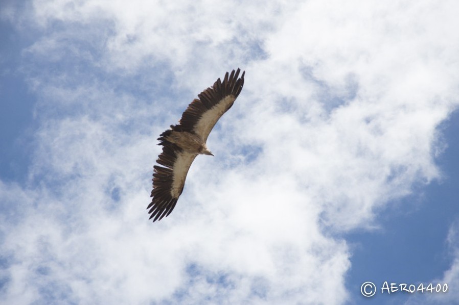

On the road ahead, I noticed many vehicles and looked up to see a large flock of vultures circling overhead—a sight even our charter driver rarely encountered.

Numerous vultures were also resting on the hillside; the driver speculated that there might be an animal carcass nearby. Sure enough, in a large pit by the roadside, the stinking carcass of a pig was being devoured in a most unsightly manner—an absolutely nauseating scene.

Yet the gruesome display took place against a backdrop of breathtaking natural beauty.

After leaving that area, we reached the famous “99 Turns” on National Highway 318 (even though the road officially has only 72 bends—the name is merely an exaggeration to emphasize its winding nature). After passing the Nu River Bridge (where photography was not allowed), we arrived at our lodging for the day: Sanjiangyuan Hotel in Basu, with standard rooms for 160 RMB. In Tibetan, “Basu” means “the village at the foot of the Warrior Mountain,” situated at 3,910 meters.


Every dinner must be sumptuous.